
How Many Fish Species Are Found In Your Country?
This map-based interactive data application creates a list of fish species by country. Many large data sets are curated by different scientific organizations and citizen scientists, alike. In this interactive application, we demonstrate how voluminous data sets can be parsed to tackle simple questions. Go to the Fish Geo App to find out how many fish species are found in your aquatic landscape.
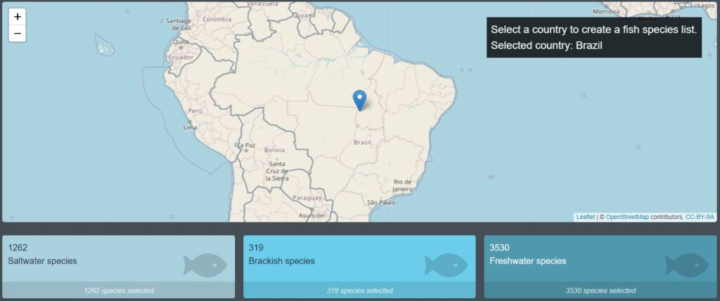
What Does This Interactive Data Application Demonstrate?
- Sharing of ecological information through an interactive map.
- Dynamic filtering of data sets, allowing users to create custom outputs.
- Cross-referencing species information from multiple sources (FishBase and iNaturalist) to create a more informative product.
Collaborators
D Njila Talla and WJ Harford